To develop an android application for crowdsourcing of infrastructure information such as road and power damage, disasters, landslides, roadblocks, power outages, critical infrastructure damage due to high wind, etc, to be displayed on a web-based geospatial dashboard along with query and basic geospatial analysis.
Business Challenges
Solution Provided
To bring CRISTA to life, we assembled a dedicated cross-functional team including a team lead, product designers, frontend and backend developers, a mobile developer, and a QA engineer.
We selected a tech stack optimized for rapid development, responsive UI, real-time communication, and geospatial data handling:
- Backend: Ruby on Rails
- Mobile: React Native
- Web: Next.js & React.js
- Database: PostgreSQL with PostGIS
Our Workflow
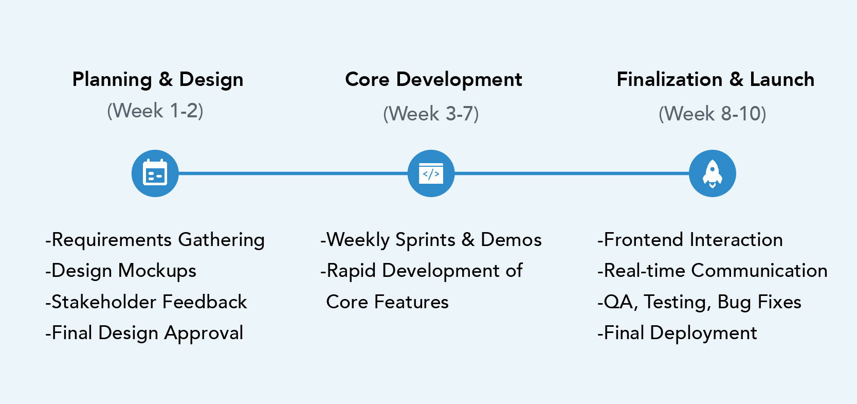
The project was executed over ten weeks using an agile approach with weekly sprints and continuous delivery.
We began with planning and design, finalizing the UI/UX within two weeks through collaborative feedback loops. Development followed swiftly, with weekly demos and real-time input from the client.
In the middle phase, we built core modules such as incident reporting, user management, and API/database integration. The final stretch focused on frontend polish, real-time features, QA, and deployment - wrapping up a successful, iterative journey from concept to launch.

Measurable Outcomes
- UI/UX design of the mobile application and web-based computer dashboard.
- Integration of the application and dashboard including seamless data transfer.
- Deployment of the application and dashboard including public user registration and authorization.
- Troubleshooting, debugging and maintenance (server, data).


